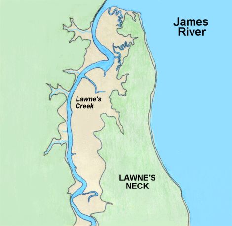
The map shows the narrow neck of land - a favourite site for early plantations as it offers good protection from native attacks, being surrounded by water and marsh on three sides and therefore requiring defence only on the narrow land side. There are a number of places on the creek that offer suitable landing places from a boat, where the river runs very close to the land : these are mainly located on bends in the river. (A good example can be seen at the very bottom of the map.)