|
Where did Hooke make his observations and which layers did he investigate?
There are several significant passages in Hooke's "Lectures and Discourses of Earthquakes and subterraneous Eruptions." concerning the Isle of Wight. |
| "The Second is an Observation of my own, which I have often taken notice of, and lately examined very diligently, which will confirm these Histories of Pliny, and this my present Hypothesis; and that is a Part of the Observation I have already mentioned, which I made upon the Western Shore of the Isle of Wight. I observed a Cliff of a pretty height, which,by the constant washing of the water at the bottom of it, is continually especially after Frosts and great rains, foundering and tumbling down into the Sea underneath it. Along the Shore underneath this Cliff, are a great number of Rocks and large Stones confusedly placed, some covered, others quite out of the Water; all which Rocks
I found to be compounded of Sand and Clay, and Shells, and such kind of Stones, as the Shore was covered with. Examining the Hardness of some that lay as far into the Water as the Low-Water-mark, I found them to be altogether as hard, if not much harder than Portland or Purbeck-stone: Others of them that lay not so far into the Sea, I found much softer, as having in probability not been so long exposed to the Vicissitudes of the Tides: Others of them I found so very soft, that I could easily with my Foot crush them, and make Impressions into them, and could thrust a Walking-stick I had in my Hand a great depth into them: Others that had been but newly foundered down, were yet more soft, as having been scarce wash'd by the Salt Water. All these were perfectly of the same Substance with the Cliff, from whence they had manifestly tumbled, and consisted of Layers of Shells, Sand, Clay, Gravel, Earth, &c. and from all the Circumstances I could examine, I do judge them to have been the Parts of the Neighbouring Cliff foundered down, and rowl'd and wash'd by degrees into the Sea; and, by the petrifying Power of the Salt Water, converted into perfect hard compacted Stones. I have likewise since observed the like Phoenomena on other Shores." |
Most of the cliffs from Alum Bay round to Cliff End are "of a pretty height". However, only the shores below the cliffs on the north side of Headon Hill and around Cliff End are subject to falls of rock, that derive from layers of limestone that outcrop at these points [see Fig. 2] The shore from Alum Bay round to Totand Bay is covered in vast amounts of limestone rock that has fallen from the several layers of Headon Hill Formation limestone. Some of this rock is very hard but other layers are formed from fossils compacted loosely in marl, which crumble readily. As Hooke mentioned, much of the rock emerges in a softer state but hardens in the air and under the action of seawater.
The cliffs in this locality slope down to the shore and are generally covered in rough grass and scrub. The ground is highly disturbed in places with fissures and pot holes that make walking somewhat hazardous without due care. In between the layers of limestone, there are clays and sands, some of which contain a variety of shell fossils in varying proportions. There are some layers that contain so many fossil shells that the layer is named after the shell that predominates. (see below)
Fig. 2: Coast at west end of the Island from the Needles round to Cliff End.
 |
|
| In this extract, Hooke mentions a stretch of cliff "almost opposite to Hurst-Castle". He adds that the cliff is made up of "Clays, Sands, Gravels and Loames ". This could be anywhere between Headon Hill and Cliff End. However, a more exact location can be arrived at. He mentions a layer about 2 foot thick, containing shells "such as Oysters, Limpits, and several sorts of Periwinkles". He also estimates that this layer is about sixty feet up in the cliff. This points to the layer being one of the several layers within the Middle or Lower Headon beds, that contain a high proportion of fossils, but most probably in either what is known as the 'Venus Bed' or the 'Neritina Bed'. Indeed the 'Venus Bed', apart from containing a large variety of gastropod and bivalve fossils, also contains a conspicuous oyster bed that varies in thickness from between 2 to 3 feet. These fossil beds can be found in the cliff on the north side of Headon Hill and they gradually descend in the cliff as it heads north towards Cliff End, eventually disappearing under the beach just north of Brambles Chine. That Hooke is not referring to Colwell Bay is clear since the fossil shell layers are at beach level here. Besides the Cliffs are either sheer or are heavily overgrown between Cliff End and Warden Point. However, these fossil beds lie at sixty feet in the vicinity of Totland and its pier and reach ninety five feet at Widdick Chine. They can most easily be accessed on the sloping cliffs either on the north-west corner side of Headon Hill or of Totland Bay. It is clear therefore that Hooke was either walking the three quarters of a mile undercliff section on the north side of Headon Hill or the half mile Totland Bay section north of Widdick Chine, which is adjacent to the Headon Hill section. The latter area is overgrown with scrub and trees and buildings and is not so easily accessible unlike Headon Hill, over which one can walk with comparative ease. However, Headon Hill undercliff is very overgrown in places with bracken, scrub and small trees, which totally obscure the ground and therefore the strata. Although the Totland Bay section is covered in thick scrub, the strata are often visible in the cliff falls that often occur here. The shells etc. are far more evident on the beach below Headon Hill of which it is partly composed, along with shingle and sand, while the shore of Totland Bay generally consists of sands and shingle. |
"To this I shall add an Observation of my own nearer Home, which others possibly may have the opportunity of seeing, and that was at the West end of the Isle of Wight, in a Cliff lying within the Needles almost opposite to Hurst-Castle, it is an Earthy sort of Cliff made up of several sorts of Layers, of Clays, Sands, Gravels and Loames one upon the other. Somewhat above the middle of this Cliff, which I judge in some parts may be about two Foot high, I found one of the said Layers to be of a perfect Sea Sand filled with a great variety of Shells, such as Oysters, Limpits, and several sorts of Periwinkles, of which kind I dug out many and brought them wth me, and found them to be of the same kind with those which were very plentifully to be found upon the Shore beneath, now cast out of the Sea. This Layer is extended along this Cliff I conceive near half a Mile, and may be about sixty Foot or more above the high Water mark."
Fig. 3: Isle of Wight showing Hurst Castle.
 
Fig. 4: View of section of the coast from Widdick Chine (far right) to Cliff End, showing Totland Bay cliffs. April 2003.
|
"For the proof of the fifth Proposition, namely, That, &c. The place I mentioned before near the Needles in the Isle of Wight afforded a most evident and convincing one as could well be desired, which was from the following Observation. I took notice that the aforesaid Earthy Cliff did founder down and fall upon the Sea-shoar underneath, which was smooth and Sandy, and bare at low Water so as to be walked on, but at high Water a great part of it was covered by the Sea. I observed several great lumps of the said Founderings lying below, some whereof, which lay next the Cliff, tho' they were somewhat harden'd together more than they were above in the Cliff, were yet not hard enough to be accounted Stone; others of them that lay further into the Sea were yet more hard, and some of the furthest I could not come at for the Water, were as hard I conceived as Purbeck(which is taken up from the Shore of Purbeck, lying just opposite to it on the West side of this Channel or Passage) divers of these Stones I observ'd to be made up of the peices of Earth that had foundred down from the Cliff, which I was assured of by carefully observing and finding divers of them to consist of the several Layers, and in the same order as I saw them in the Cliff; among the rest I found divers that had the Layer of Sea Sand and Shells which I had observed in the Cliff inserted in the Stone with the adjoyning Layers all petrify'd together into a hard Stone. Here I found multitudes of the said Shells I before mention'd to have observ'd in the Cliff, mix'd loosely with a Sea Sand; now together with the the said Sand both fill'd, inclos'd, and petrify'd altogether, and I broke off many peices of the said Rocks, where I found the said Petrifactions, and found them much like other Stones I had seen from other Inland Quarries here of England, wherein I had observ'd also such kind of petrify'd Shells, tho' how they came to be so Petrify'd I could not be so well inform'd. For that which I conceive was the cause of this suddain Petrifaction (for I conceive those that I examin'd had not been Stones for many Years, which I judged by their distance from the present Cliff, and from the quantity thereof, which Communibus Annis did founder down) was that close by this Cliff, there is a vitriolate or aluminous Spring or Rill which runs into the Sea, where formerly those Salts have been made of it by boyling, but has been now omitted for many Years. These saline Springs or Rills I conjecture mixing with the Sea-Water, may be the cause of the said Petrifaction, and the want of it is the cause why other founderings in other parts of the said Cliff are not at all so Petrify'd." |
The shore at Totland Bay is indeed still "smooth and Sandy, and bare at low Water so as to be walked on". The sloping cliff here can certainly be described as an "Earthy Cliff". The limestone layer that protrudes from the cliff here is the Hatherwood limestone member and is very fossiliferous and crumbly. The blocks that fall out of the cliff are easily knocked to pieces with a stick or foot. 
Fig. 6: Section of cliff north of Totland Pier, showing fossiliferous Limestone layer. In the foreground, there is a block that has fallen from the cliff and its crumbly, friable nature can be seen. The foot of the cliffs in Totland are now protected by a concrete sea wall. But on the top of it, blocks of the fossiliferous limestone can be found, having fallen from the layer high up in the sloping cliff. Much of these cliffs are covered in scrub and small trees, but north of Totland pier, the cliff is covered in large areas of rough grass with patches of gorse and brambles. It is here some good fossiliferous sections of the Headon Formation can be seen. The area in question strongly suggests a location in Totland Bay close to Widdick Chine, where a small stream runs down to the shore. This stream may be the "Spring or Rill", to which Hooke refers. However, the use of the terms "vitriolate or aluminous" in describing this stream would rather suggest the stream at Alum Bay Chine, where there had indeed been an attempt to manufacture alum in the sixteenth century. There is also a spring in the middle of the undercliff on the north side of Headon hill and a stream that flows from it down to the beach. |
 |
The three layers of limestone(Lacey's Farm, Hatherwood and How Ledge) emerge from the cliff at Headon Hill and are quite accessible on foot. They are best seen above Hatherwood Point on the north-west part of Headon Hill.They are all fossiliferous containing fossils of freshwater snails, Galba (Limnaea) and Planorbis. In some parts of these beds the limestone strata is poorly compacted and the matrix is soft and earthy. In such crumbly layers, the fossils literally fall out and are easily extracted, allbeit in a rather fragile state. 
|
| The Fossil Beds in the Headon Member The Headon member is highly fossiliferous in places. The Lower and Upper Headon contain great numbers of freshwater and brackish specimens, while marine bivalves and gastropods abound in the Middle Headon beds. There are several horizons that are packed full of shells and form conspicuous bands in any revealed section, most notably in cliff faces. Most noticeable of these horizons, the Venus and the Neritana Beds contain various fossils of a large number of different shells of marine origin.
In the top part of the Middle Headon, just underneath the Hatherwood limestone, there is a layer, sometimes referred to as the 'Batillaria Bed', that is crowded with univalve shells, such as Potamides(Cerithium), Cyrena Obvata, Ostrea, Natica (a type of periwinkle) but with Batillaria (Cerithium Concavum) predominating. These latter can easily be found intact in the north-eastern sloping cliff of Headon Hill and in the sloping cliff slightly north of Totland pier.
Six feet or so below this bed, the so called 'Venus Bed' appears. This horizon contains a great many fossils, most particularly a layer, in which oysters (Ostrea Velata) predominate, thus giving it its name of the 'Colwell Bay Oyster Bed', since it is in this bay that the layer attains its greatest thickness.
Immediately below the 'Venus Bed' occurs the 'Neritina bed', another section that is full of fossils of bivalves and univalves such as Neritina, Cyrena obovata, Potamides (Cerithium), Batillaria and Melanopsis.
About 40 feet below this, there is the 'Cyrena Pulchra Bed', containing Cyrena Pulchra, Potamomya and Limnaea. The 'Cyrena Cycladiformis Bed' occurs 10 to 15 feet below this and reveals fossils of Cyrena Cycladiformis, Potamomya and Potamides (Cerithium).
All the above beds are interspersed among various layers of clays and sands. Layers of freshwater limestone of varying thicknesses occur at intervals in the Upper and Lower Headon beds, invariably containing mainly Galba (Limnaea Longiscata) and Planorbis, but also sometimes Viviparus (Paludina) and Melanopsis. Much of this limestone is compact but certain horizons are very shelly, and therefore soft and crumbling. One can easily pull it apart with one's hands but the shells are also apt to disintegrate quickly. Sometimes the shells leave casts in the rock which have been filled with a calcium carbonate matrix, preserving the form of the shell. In other places the shell itself has been preserved, and is empty of any matrix. It is these limestone layers that out-crop on the beach as How Ledge and as a reef off the beach at Totland Bay. However, Warden Ledge is composed of a calcerous sandstone which, although comparatively soft in the cliff, hardens in salt water to form a dangerous rock ledge.
|
Fossil Shells within the Headon Member The fossil shells shown below represent the most common types. There are quite a number of other fossil shells that occur in these strata, but they are not as numerous.
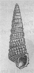  | (left) Potamides (formerly known as Cerithium pseudo-cinctum. (Right) Batillaria, formerly known as Cerithium concavum. |
 | Formerly known as Venus incrassata. Gave its name to the 'Venus Bed', owing to the predominance of this shell. |
 | Neritina shells of the periwinkle type. |
Ostrea velata.
 | A species of oyster, which makes up the 'Colwell Bay Oyster Bed'(below), along with Nucula. 
|
Nucula headonensis.
 |
 | Cyrena pulchris, after which the 'Cyrena Pulchris Bed' is named. |
 | Potamomya bivalve that occurs regularly though the Upper and Lower Headon Beds. |
 | Corbicula obovata (formerly known as Cyrena obovata), a marine bivalve, occurs throughout the Middle Headon bed. |
 | Section of the cliff, showing the Hatherwood limestone, containing fossil shells. Directly above it, there is a typical fossiliferous layer, consisting of marl and lots of fossil shells. The dark layer below the Hatherwood limestone is a soft, crumbly limestone - again full of shells, mainly Galba (Limnaea). |
|
Investigation of the Chalk Strata:
It is clear from a page of illustrations, published in Hooke's "Posthumous Works", showing drawings of fossils by Hooke, that he also visited the chalk cliffs of the west end of the Island. In amongst shark's teeth and other shells, he has drawn pictures of several belemnite fossils, which, on the Island, derive from the Cretaceous layers. The nearest areas of Cretaceous rocks is at Freshwater Bay, south of his old home, and also the towering chalk cliffs that terminate in the Needles rocks, accessible from Alum Bay. |
|
|